Walking
Walking in Kingussie
Kingussie is an ideal base for walking and whether you are interested in a scenic woodland stroll, a moderate walk or a full day hike it's all there waiting.

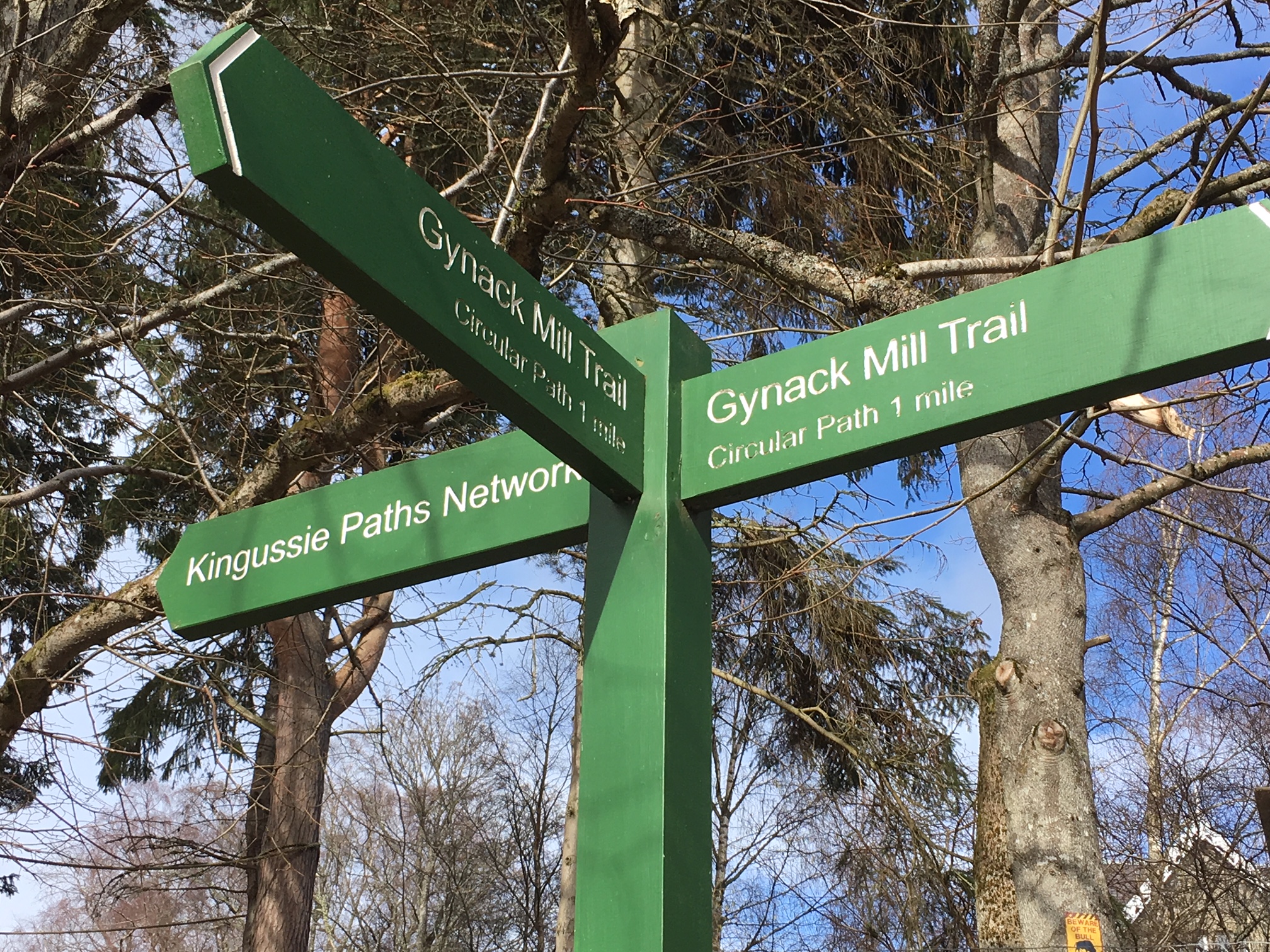
Kingussie Paths Network
A variety of pleasant local walks on well-maintained and way-marked paths network.
All of these are featured on the KCDC’s guide map which can be downloaded here
Gynack Mill Trail
A walk along the Gynack burn through woods on good paths with interpretation panels describing the natural surroundings and historical context. 1 hour. Easy.
West Terrace Circular
A circular walk on quiet roadways with impressive 19th century villas, then through woodland and hillside. Views over the Spey valley. 1.5 hours. Easy, includes some moderate gradients.
Tom Baraidh Circular
A pleasant way-marked route on forest paths in mature Scots Pine woodland. 2 hours. Easy, includes a moderate gradient in one section.
Raitts township
A way-marked linear route on a grassy trail through fields and juniper woodland to the ruined settlement at Raitts. Little remains of the buildings but this is an atmospheric site given special significance as this settlement has been recreated at the Highland Folk Museum. 1.5 – 2 hours there and back, can be extended by combining with the Tom Baraidh Circular. Dogs should be kept on a lead at the township site itself due to sheep. Easy, with some uneven ground.
Golf Course Circular
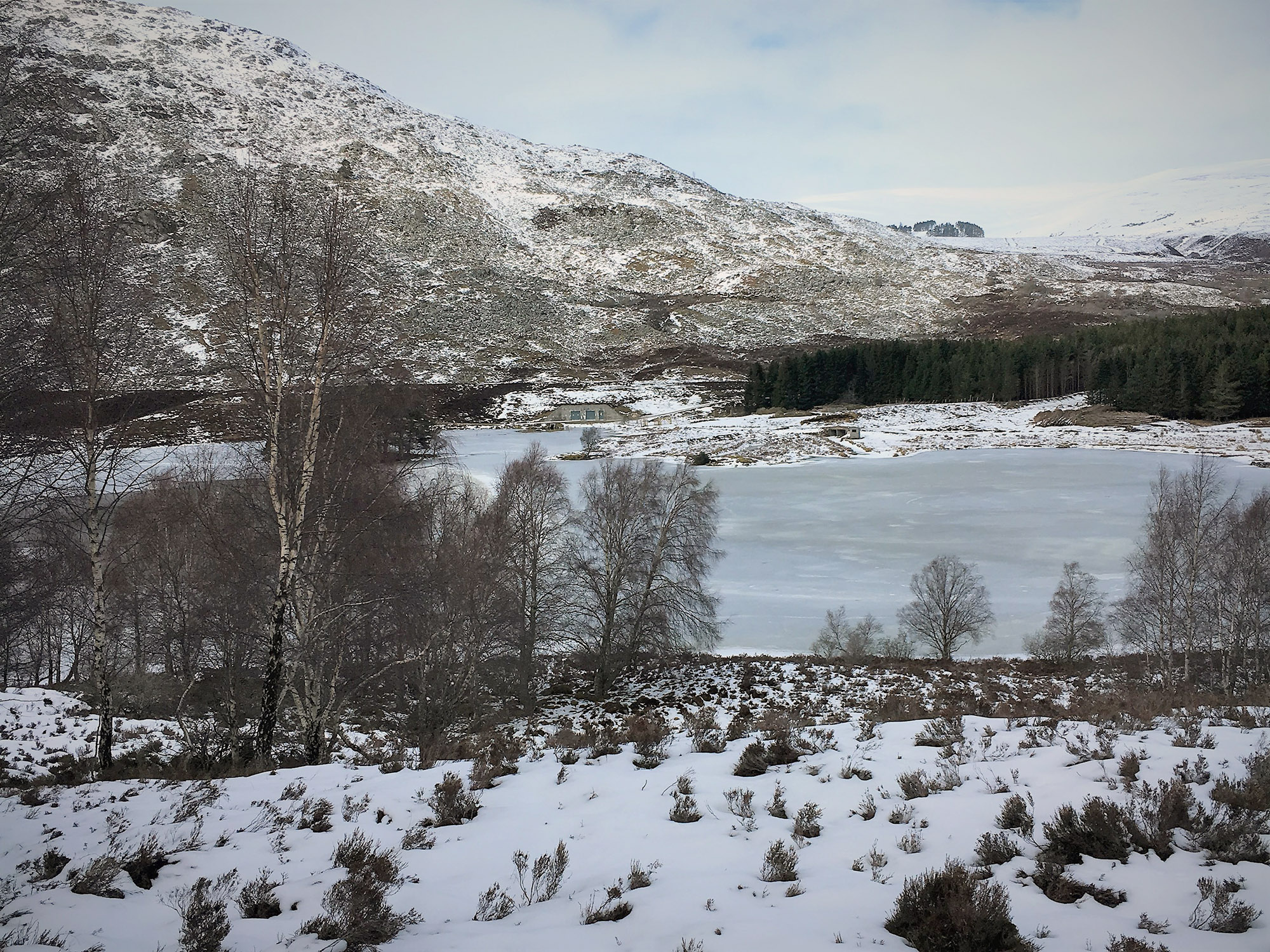
An excellent way-marked circular route following the Gynack Burn upstream, through birch woodland to the picturesque Loch Gynack. 1.5 hours. Easy, with some uneven ground, can be muddy.
Creag Bheag
3 mile circular path on the hill (487 m) overlooking Kingussie. Although a short hill climb the views from the summit over the strath and towards the Monadhliath hills are outstanding. 2.5 hours. Moderate hill walk, steep in places. For a more detailed route map see Walking Highlands page.
Loch Gynack path to Newtonmore
A longer walk sharing the same outward path as the Golf Course Circular as far as Loch Gynack. Then follows a well maintained path along the south side of the Loch through birch woods. Continues until joining up with the way-marks leading down to Strone Road, Newtonmore. From the circular route follows the off-road cycle path back to Kingussie. 2.5 – 3.5 hours.
For a more detailed route map see Walking Highlands .
Information
Sensible shoes will be required for all walks listed here, for longer walks and hills hiking boots and suitable preparation will be essential. While Scottish hills appear straight-forward on a sunny summers day, they should always be treated with respect as weather can change quickly. Remember to take adequate clothing, insect repellent, a working mobile phone and always let someone know your intended route.
Although in Scotland we have extensive rights of access, there are some guidelines to be aware of. The Outdoor Access Code is available here.
Short Town Walks
Pleasant short walks in and around Kingussie, taking in the local nature trails and sites of historical interest.
All of these are described with maps on the Independent Walks Around Kingussie leaflet.
The Glebe Ponds
A half hour town walk around the well maintained duck pond at the eastern end of the town. Can be extended by continuing along High Street to the Witches Hill or Kingussie Cemetery.
Jubilee Walk
A half hour town walk through Scots Pines and following the Gynack Burn downstream.
The Dell
A half hour town walk around the iconic home of Kingussie Camanachd Shinty Club. Can be combined with the Jubilee Walk or further extended by following grassy trails along the banks of the Spey.
Hazel Woods
A half hour walk on well maintained paths upstream alongside the River Gynack and through hazel woods. Impressive bridge views over river gorges and waterfalls. Information boards provide historical and woodland context.
Ruthven Barracks
A slightly longer walk of 1 – 1.5 hours passing over the river Spey and out to the historical site of the Ruthven Barracks. Information boards provide historical context. Fantastic views over the Insh Marshes, Monadhliath mountains to the east and Cairngorms in the west.
Kingussie Town Trail
Discover the town and its history with the interpretative Town Trail guide.
Longer Walks starting in Kingussie
Ruthven and Glen Tromie Circuit
A longer walk starting along tracks and footpaths to cross the open hill of Beinn Bhuidhe and down into Glen Tromie. Then follows the private road back down the quiet and pleasant Glen, a section of the Badenoch Way and then back along a minor road back to Ruthven.
- 4 – 5 hours, shorten by 1 hour by parking at Ruthven car park.
- For a route map see Walkhighlands page.
- Features in the “Speyside Walks” booklet.
Badenoch Way
A full day walk on a way-marked trail starting at the RSPB Insh Marshes car park, roughly following the River Spey. A varied route leading through the Insh Marshes, moorland, farmland and woodland and ending at the Dalraddy caravan site beyond Kincraig.
- 5-6 hours one way, add one hour if starting from Kingussie town. Bus from Aviemore for the return.
- For a route map see the Walkhighlands page
Carn an Fhreiceadain (875 m)
Known as Kingussie’s Corbett this is a great introduction to the less well known Monadhliath mountains. The route follows well maintained estate tracks but despite being within easy walking distance of the strath does have a sense of remoteness. The summit cairn provides views across a wide area of the Monadhliaths. Features in the Pathfinder “Cairngorm Walks”. 4 -5 hours.
For a route map (and pronounciation guide!) see Walkhighlands page.
Maps and Books for Monadhliaths & Cairngorms
Maps
- Badenoch and Upper Strathspey (Explorer Maps) (OS Explorer Map)
- Kingussie and Monadhliath Mountains (Landranger Maps)
Books
Cairngorm Walks, Pathfinder Guide.
John Brooks, Neil Wilson, Peter Koch-Osbourne. 6th Edition, Jarrold Publishing 2007.
Walks: Speyside
Richard Hallewell, Hallewell Publications 1999.
The Cairngorms: Walks, Trails and Scrambles
Ronald Turnbull, Cicerone Press 2005
Aviemore and the Cairngorms: 40 Shorter Walks
Paul and Helen Webster, Pocket Mountains 2005
Maps and books can be bought locally in the Paper shop on King Street. Service Sports on High Street also sell maps and books, hiking gear, socks etc.